

Revolutionizing 2D and 3D Photogrammetry for Central Florida Industries.
Aerial mapping, facilitated by automated and intelligent drones, harnesses the power of drone photogrammetry to deliver swift and precise data acquisition, benefiting industries across Orlando and Central Florida. From construction, agriculture to land management, the advantages of drone technology offers invaluable cost-effective insights for informed decision-making and targeted actions.
2D Mapping
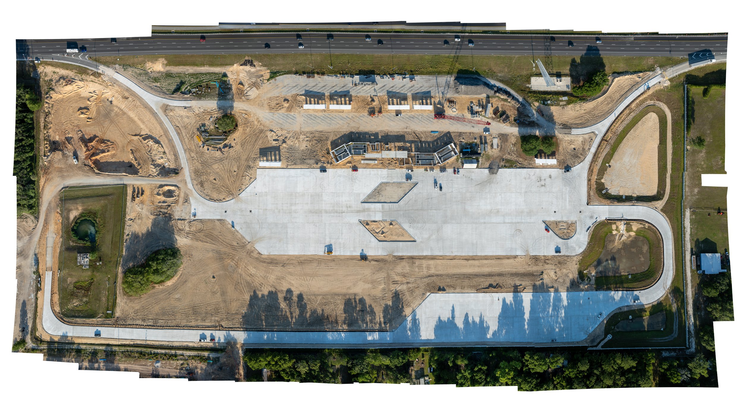
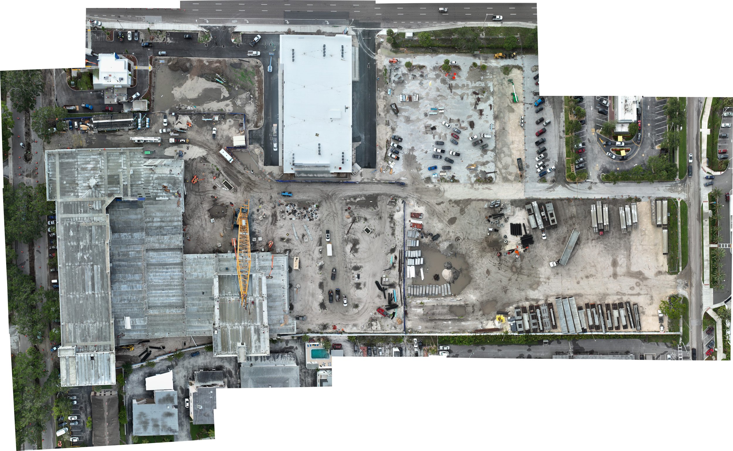
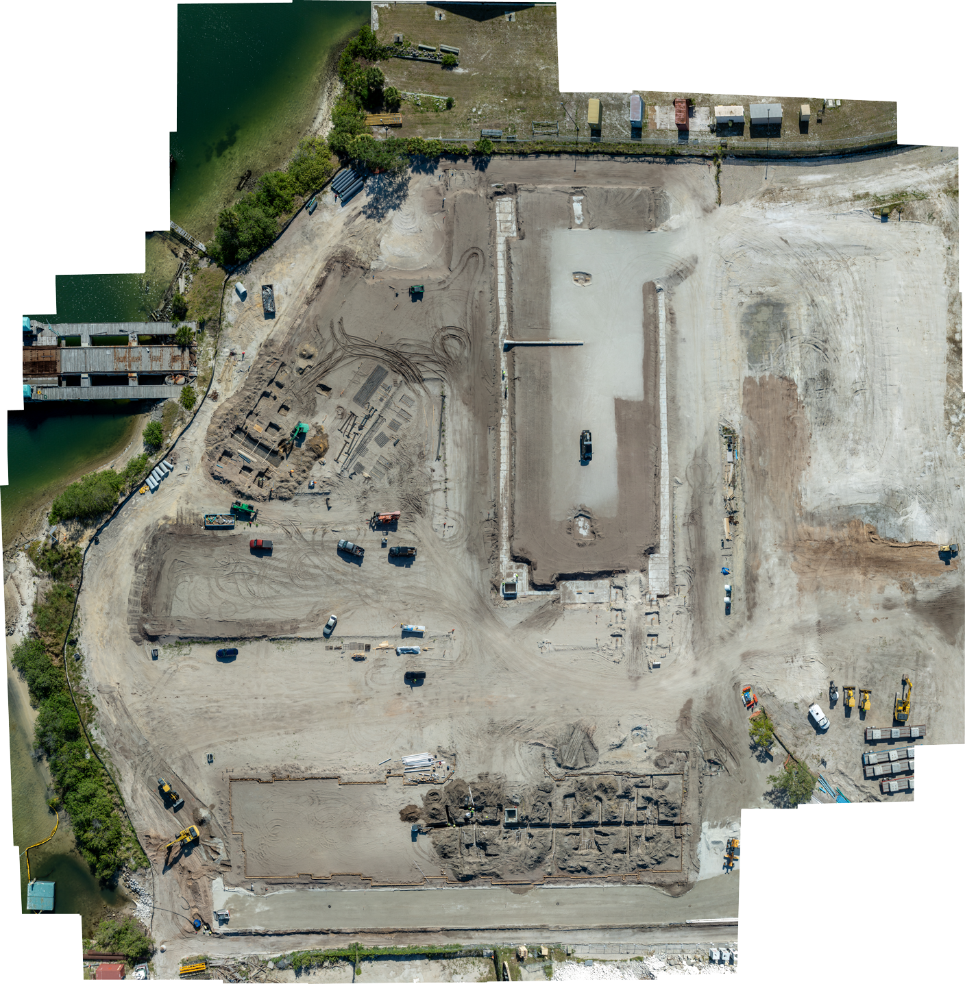
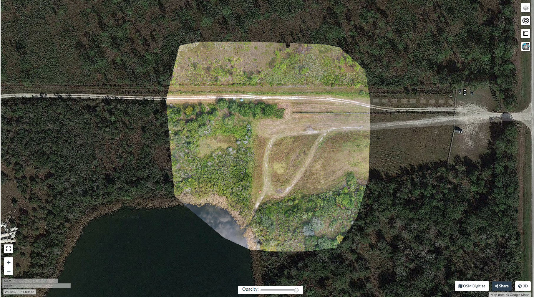
Nona Drone, as a leading drone service provider, harnesses the power of 2D drone photogrammetry to revolutionize industries such as construction, agriculture, and land management. Beyond traditional methods, this technology offers significant advantages by capturing high-resolution aerial imagery, enabling construction teams, architects, and stakeholders to monitor project progress and make informed decisions. By generating detailed maps and models, 2D drone photogrammetry facilitates progress tracking, ensuring adherence to project timelines and budgets while enhancing safety and reducing operational costs. Moreover, in agriculture and land management, Nona Drone's photogrammetry services empower farmers and land managers with detailed aerial imagery for crop monitoring, land use analysis, and ecosystem monitoring, facilitating informed decision-making and effective land conservation strategies.