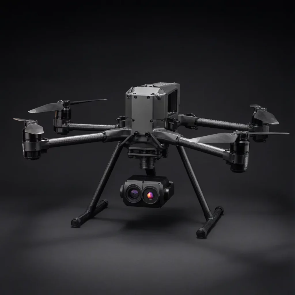
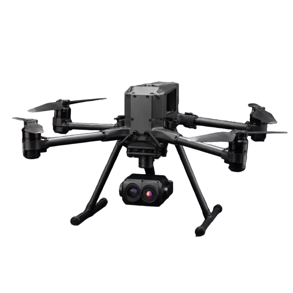
ND-T600 Thermal Inspection System
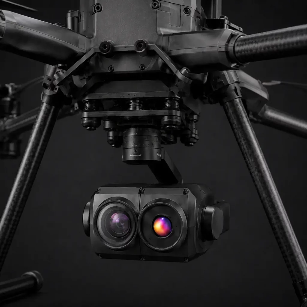
Professional hexacopter system with radiometric thermal and RGB imaging for industrial inspection, building diagnostics, and asset monitoring.
640×512
Thermal Resolution
Yes
Radiometric
2 °C
Measurement Accuracy
-20 °C
Temperature Min
550 °C
Temperature Max
48 MP
RGB Camera
4 ×
Optical Zoom
From
$23,000
Final pricing depends on payload configuration, batteries,
accessories, positioning options, software, and support requirements
Request a Quote
Tell us about your requirements and we’ll provide pricing and configuration details.
Ready-to-Deploy
Verified Specifications
U.S. Support
NDAA Compliant
On this page:
Specifications
Software
Workflow
FAQ
Software and Data Workflow
The mission continues after landing. A professional workflow turns a field operation into information that can be reviewed, delivered, and integrated.
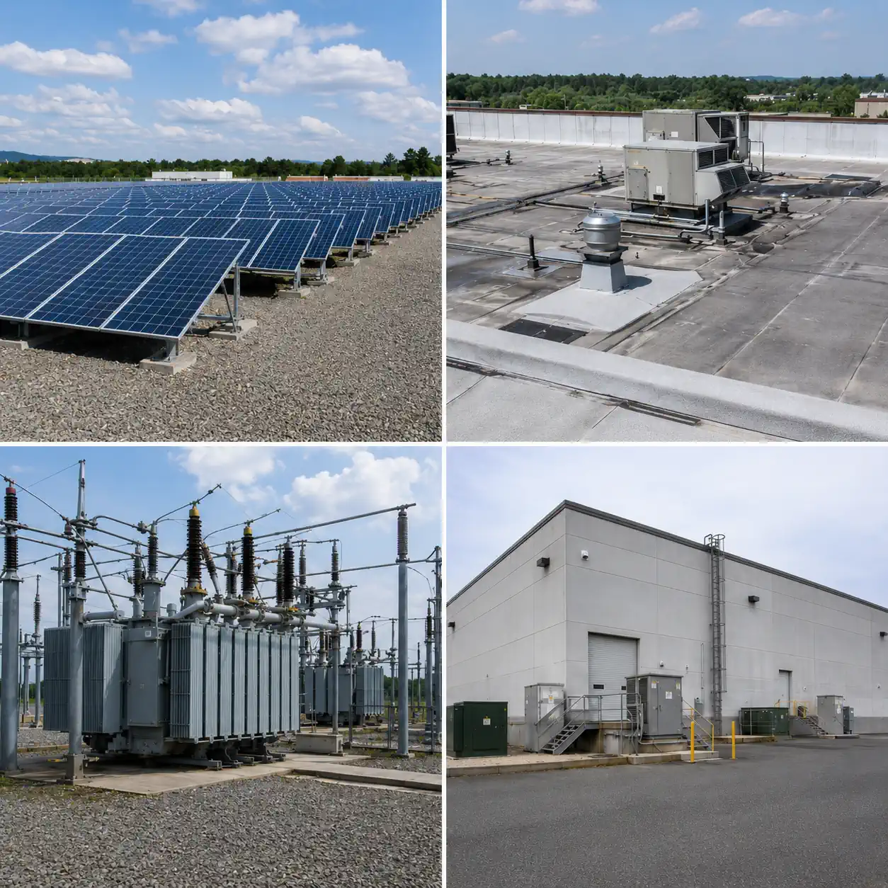
Electrical Inspection
Inspect transformers, switchgear, connections, and other electrical infrastructure for abnormal thermal patterns that may indicate overheating or developing component issues. Remote data capture helps evaluate difficult-to-access equipment while maintaining practical stand-off distance.
Industrial Asset Inspection
Collect thermal and visual data from buildings, mechanical equipment, process infrastructure, and other industrial assets. The system supports repeatable inspection routes and consistent data capture for recurring condition monitoring, maintenance planning, and documentation.
Solar Inspection
Detect hotspots, cell-level temperature differences, and abnormal heating patterns across photovoltaic installations. Thermal and RGB data can be captured during the same inspection workflow to support faster identification of underperforming modules and areas that require closer review
Roof Inspection
Capture thermal data across commercial and industrial roofing systems to help identify temperature irregularities associated with moisture intrusion, insulation defects, and heat loss. RGB imagery provides additional visual context for documenting roof condition and planning follow-up inspection.
Specifications
Review the key technical specifications of this drone configuration, including aircraft performance, positioning systems, and thermal and RGB imaging capabilities.
Aircraft
Aircraft Type
Multirotor
Defines the aircraft platform and its basic flight configuration.
Flight Time
52 min
Maximum stated airborne time per flight for this configuration.
Operating Range
32 mi
Maximum stated operating distance supported by the aircraft and control link.
Payload Capacity
3 kg
Maximum payload weight the aircraft platform is designed to carry.
Frame Size
905 mm
Overall platform size, useful for transport, deployment, and operating-space planning.
Max Wind Speed
10 m/s
Maximum stated wind speed for operation of the aircraft.
Positioning
Positioning Systems
GNSS / RTK / PPK
Positioning technologies available for navigation and repeatable data capture.
Thermal & RGB Imaging
RGB Camera Resolution
48 MP
Determines the level of visible-image detail available for inspection and documentation.
Optical Zoom
4 ×
Provides closer visual detail while maintaining greater distance from the inspected asset.
Thermal Resolution
640 × 512
Determines the spatial detail available in the thermal image.
Radiometric
Yes
Indicates whether temperature values are recorded for individual pixels in the thermal image.
Temperature Accuracy
2 °C
Stated temperature-measurement accuracy of the thermal sensor.
Temperature Range
-20 to 550 °C
Temperature interval the thermal sensor is specified to measure.
Compatible Software
This drone configuration supports a range of software tools for flight planning, thermal analysis, photogrammetry, mapping, and inspection reporting. Compatibility depends on the selected flight controller, payload, data formats, and final system configuration.
QGroundControl
Aircraft, payload, software, batteries, accessories, and supporting equipment configured as one complete solution.
Mission Planner
Ground control software for ArduPilot-based aircraft. Used for mission planning, flight monitoring, parameter configuration, log review, and repeatable automated missions.
FLIR Thermal Studio
Thermal analysis and reporting software for compatible radiometric FLIR datasets. Supports temperature review, annotations, image analysis, and professional thermal reports.
Pix4Dmapper
Photogrammetry software for processing aerial RGB imagery into orthomosaics, point clouds, 3D models, measurements, and georeferenced datasets.
Frequently Asked Questions
What is this drone designed for?
This multirotor drone is configured for professional thermal and visual inspection work. The combined thermal and RGB payload allows operators to document visible conditions and temperature patterns during the same inspection workflow. Typical uses include commercial roofs, solar installations, electrical infrastructure, industrial facilities, and other assets where visual and thermal data are useful for assessment and documentation.
Does this drone carry both thermal and RGB cameras?
Yes. This configuration combines thermal imaging with an RGB camera, allowing the operator to collect thermal and visible imagery from the same aircraft. The RGB camera provides visual context and detailed documentation, while the thermal sensor is used to identify and record temperature differences that may require further review.
What can this drone inspect with a thermal camera?
The system can be used for thermal inspection of assets such as commercial roofs, photovoltaic arrays, electrical equipment, building envelopes, and industrial infrastructure. The exact inspection method depends on the asset, environmental conditions, required measurement quality, sensor specifications, flight distance, and the reporting standard used for the project.
Is the thermal camera radiometric?
Radiometric capability is shown in the technical specifications for this configuration. A radiometric thermal sensor records temperature-related information at the pixel level rather than providing only a visual heat image. This makes the captured data more useful for workflows where temperature measurements and post-flight thermal analysis are required.
Can this drone perform repeatable inspection missions?
The aircraft can support repeatable inspection workflows when used with the available positioning and mission-planning capabilities. Repeatable routes and viewpoints can help operators capture comparable imagery during scheduled inspections. Actual repeatability depends on positioning quality, flight planning, environmental conditions, sensor settings, asset access, and consistent operating procedures.
What positioning systems does this drone support?
The available positioning technologies are listed in the technical specifications for the aircraft configuration. GNSS, RTK, and PPK capabilities can support navigation, mapping, georeferenced data collection, and repeatable mission workflows. The positioning method used for a project should be selected according to the required accuracy and the type of final deliverable.
How long can this drone stay in the air?
The stated maximum flight time for this configuration is 52 minutes. Actual flight time can vary with payload weight, battery condition, wind, temperature, flight profile, speed, and operating reserves. Mission planning should therefore use realistic working endurance rather than assuming the maximum stated value will be available during every flight.
What is the operating range of this drone?
The stated operating range is up to 32 miles for the aircraft and control-link configuration. This figure describes platform capability and does not by itself define the distance at which a particular mission may legally or safely be conducted. Operational range is also affected by communications, terrain, interference, regulatory requirements, weather, battery reserves, and the selected flight profile.
How much payload can this drone carry?
The aircraft has a stated payload capacity of up to 3 kg. Payload capacity is relevant when evaluating alternative sensors, mounting hardware, or custom equipment, but maximum payload should not be treated as the normal operating target. Added mass can affect flight time, handling, wind performance, center of gravity, and available safety margin.
Can this drone be used for solar panel inspections?
Yes. The thermal and RGB configuration is suitable for collecting inspection data from photovoltaic installations. Thermal imagery can help identify temperature patterns that warrant further investigation, while RGB imagery provides visual context for panel condition and location. Flight timing, irradiance, weather, viewing angle, altitude, and inspection methodology must be controlled when reliable solar inspection data is required.
Can this drone be used for commercial roof inspections?
Yes. The system can collect both visual and thermal imagery of commercial roofing systems. Depending on the inspection method, thermal data may help reveal temperature patterns associated with areas requiring closer investigation, while RGB imagery provides detailed visual documentation of membranes, seams, penetrations, drainage areas, flashing, and other roof features.
Can this drone be used for electrical and industrial inspections?
Yes. The combination of thermal and RGB imaging can support inspection of electrical and industrial assets where safe-distance visual and thermal data collection is appropriate. Potential targets include electrical connections, switchgear, transformers, substations, building systems, and other infrastructure. Thermal anomalies should be reviewed in context by qualified personnel rather than treated as an automatic diagnosis.
How should this drone be configured for a specific inspection job?
The configuration should be selected around the required inspection result rather than a single aircraft specification. Important factors include the asset being inspected, required thermal resolution, RGB detail, working distance, temperature-measurement requirements, positioning accuracy, flight duration, software workflow, environmental conditions, and final report format. The complete aircraft, payload, software, and operating workflow should be verified for the intended task before deployment.