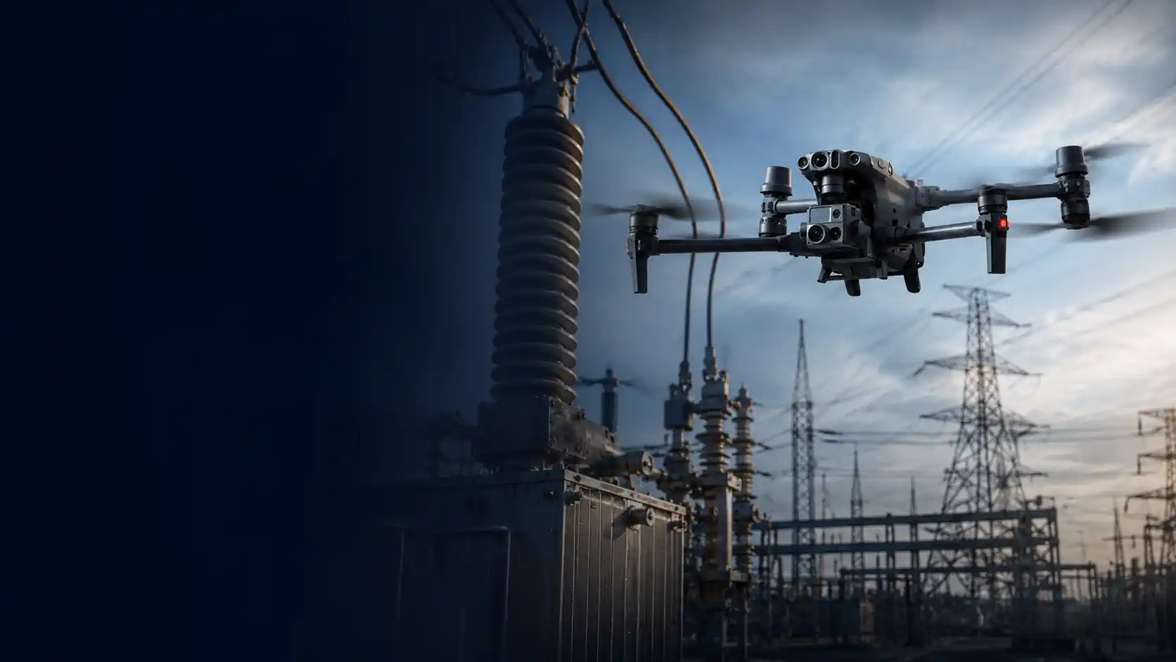
Utility Inspection Drones
Find a ready-to-deploy solution built for the way you work.
Select the Right Drone System
Describe what you need the drone system to do, or use our guided selector.
Loading selector...
Roof Inspection Drones
Find a ready-to-deploy solution built for the way you work.
Select the Right Drone System
Describe what you need the drone system to do, or use our guided selector.
Loading selector...
Utility Inspection Drones for Electrical Infrastructure
Utility inspections can involve distribution poles, transmission lines, substations, transformers, insulators, conductors, connectors, and vegetation near electrical infrastructure. Each asset creates different requirements for camera detail, thermal capability, operating distance, flight control, endurance, and data management.
A compact drone may be sufficient for inspecting individual poles or equipment at a small substation. Long transmission corridors and large facilities may require longer flight time, high-zoom payloads, radiometric thermal cameras, accurate positioning, automated data collection, or LiDAR.
Nonadrone helps you compare ready-to-deploy utility inspection drone systems based on the assets being inspected, required defect visibility, safe operating distance, sensor type, flight method, and data workflow.
What Utility Inspection Drones Can Document
Drones can capture detailed imagery of utility assets that may otherwise require climbing, elevated work platforms, or inspection from the ground.
Depending on the payload and inspection method, a drone system may help document:
- damaged or contaminated insulators;
- corrosion, cracks, deformation, and missing components;
- conductor, connector, and attachment conditions;
- damaged poles, crossarms, and support structures;
- loose or visibly displaced hardware;
- temperature anomalies in electrical components;
- vegetation encroachment near lines and structures;
- conditions affecting access roads or rights-of-way;
- changes identified during recurring inspections.
Drone imagery does not independently establish the cause, severity, or electrical consequences of a suspected defect. Findings may require review by qualified utility personnel and verification using maintenance records, electrical data, field testing, or a closer physical inspection.
Distribution Line and Pole Inspections
Distribution systems often contain closely spaced assets positioned along roads, residential areas, commercial properties, and uneven terrain. Inspections may require frequent aircraft repositioning and controlled flight around wires, trees, buildings, traffic, and other obstacles.
A suitable distribution inspection drone may need:
- responsive manual flight controls;
- a high-resolution visible camera;
- optical zoom for viewing smaller components from a greater distance;
- stabilized image capture;
- thermal capability for inspecting energized equipment;
- reliable positioning and obstacle awareness;
- sufficient portability for repeated deployment along a route;
- software for organizing images by pole or asset location.
Maximum operating range is not the same as a practical inspection distance. The aircraft must remain within applicable operating limits, while the camera must capture enough detail from the distance required by the site and asset.
Transmission Line and Corridor Inspections
Transmission inspections may cover towers, conductors, insulators, fittings, shield wires, and vegetation across long linear corridors.
For these operations, the complete workflow may require:
- longer aircraft endurance;
- high-resolution zoom imaging;
- radiometric thermal data;
- accurate image geotagging;
- repeatable routes;
- sufficient batteries and field charging capacity;
- terrain and elevation awareness;
- structured asset identification;
- software for managing large image datasets;
- LiDAR or photogrammetry for corridor and vegetation analysis.
A long advertised control range does not automatically make a drone suitable for corridor inspection. Visual-line-of-sight requirements, terrain, vegetation, communications, access points, crew positioning, airspace, and available authorization determine how the mission can legally and safely be divided into operating segments.
Substation and Electrical Equipment Inspections
Substations contain dense groups of equipment with different shapes, materials, temperatures, and operating conditions. The aircraft may need to capture components from several controlled angles while maintaining an appropriate distance from energized infrastructure.
Visible cameras can document corrosion, damaged components, contamination, fluid staining, displaced hardware, and other observable conditions.
Thermal cameras can identify surface temperature differences across connections, switches, bushings, transformers, and other components. Radiometric thermal imagery may be required when the operator needs to retain temperature data for later analysis and reporting.
A thermal anomaly does not automatically confirm a failing component. Electrical load, emissivity, reflections, weather, viewing angle, and comparison with similar equipment can affect the apparent temperature. Thermal findings should be interpreted within the operating context of the asset.
Visible, Zoom, and Thermal Payloads
Utility inspections frequently require more than one camera capability.
A high-resolution visible camera provides general asset documentation and detailed still images. Optical zoom allows smaller components to be inspected while the aircraft remains farther from wires, structures, or energized equipment.
Thermal imaging adds the ability to locate temperature differences that may indicate a connection, component, or section requiring further investigation. For measurement-oriented work, radiometric thermal data is generally more useful than a live thermal view without retained temperature information.
A combined payload can keep visible and thermal imagery aligned within the same inspection workflow. This makes it easier to associate a temperature anomaly with the corresponding physical component.
The required payload should be selected according to the smallest condition that must be documented and the distance from which the aircraft can reasonably collect the image.
LiDAR and Vegetation Management
LiDAR may be useful when the inspection requires three-dimensional information about conductors, structures, terrain, or vegetation within a utility corridor.
Depending on the sensor, positioning system, flight plan, and processing software, LiDAR data can support:
- vegetation-clearance analysis;
- conductor and structure modeling;
- terrain mapping beneath partial vegetation cover;
- right-of-way documentation;
- change analysis across repeated surveys;
- identification of areas requiring closer review.
LiDAR is not required for every utility inspection. Visible or thermal imagery is usually more practical for documenting individual component conditions. LiDAR becomes relevant when accurate spatial relationships, corridor geometry, or vegetation clearance are part of the required deliverable.
The aircraft, LiDAR payload, GNSS equipment, calibration procedure, and processing software must be evaluated as one system.
Manual Inspections and Repeatable Data Collection
Manual flight is often appropriate for individual poles, substations, targeted follow-up work, and assets that must be viewed from several angles.
Automated or preplanned missions may be more useful when the operation requires:
- consistent coverage across many similar assets;
- repeatable inspections over time;
- systematic collection along a corridor;
- mapping or three-dimensional reconstruction;
- standardized image angles and distances;
- comparison with previous inspection records.
Some utility workflows combine both methods. A planned mission provides broad and repeatable coverage, while a manual follow-up flight captures additional detail around selected components or anomalies.
Utility Inspection Software and Asset Records
Flight software controls the aircraft and image collection, but utility inspection programs may require additional tools to manage the resulting data.
Compatible professional software may be used to:
- associate images with poles, towers, or equipment records;
- compare visible and thermal imagery;
- annotate suspected conditions;
- classify and prioritize findings;
- review radiometric temperature data;
- process photogrammetry or LiDAR datasets;
- compare inspections performed on different dates;
- generate maps and inspection reports;
- export findings to asset-management or maintenance systems.
Software compatibility should be confirmed for the exact aircraft, payload, image format, positioning method, and required deliverable. Capturing usable imagery is only the first stage of a complete utility inspection workflow.
Ready-to-Deploy Utility Inspection Solutions
The systems presented on this page are evaluated as complete working solutions rather than standalone aircraft.
Depending on the selected configuration, a solution may include:
- the drone platform;
- high-resolution visible, optical zoom, thermal, or combined payload;
- radiometric thermal imaging capability;
- LiDAR payload and positioning equipment;
- batteries and field charging equipment;
- controller and operator display;
- flight and mission-planning software;
- compatible inspection, thermal analysis, mapping, or LiDAR software;
- transport and storage equipment;
- setup, training, warranty, and manufacturer support.
Each product page identifies the included equipment, compatible professional software, available options, and components or licenses that must be purchased separately.
Final configuration should be confirmed for the asset type, required level of detail, operating distance, site conditions, inspection frequency, and data workflow.
Commercial Operating Requirements
Utility inspection flights must comply with the operating rules applicable to the pilot, aircraft, airspace, location, and proposed mission.
Operations near roads, people, vehicles, buildings, airports, or critical infrastructure may require additional mission planning and site-specific authorization. A utility company’s permission to inspect an asset does not replace applicable FAA requirements or authorization from the property owner.
Long transmission corridors do not automatically permit extended-range or beyond-visual-line-of-sight flight. Missions must remain within applicable operating limitations unless the operator holds the required FAA authorization.
Operational requirements should be confirmed for the aircraft, inspection location, crew structure, and intended flight method before the system is placed into service.
Find the Right Utility Inspection Drone System
Use the Nonadrone selector to specify whether you inspect distribution lines, transmission infrastructure, substations, individual poles, electrical equipment, or utility corridors.
The selector compares your requirements with confirmed product specifications, including visible detail, optical zoom, thermal capability, LiDAR compatibility, operating distance, flight automation, positioning, software, and field workflow.
Frequently Asked Questions (FAQs)
The required drone depends on the asset and inspection objective. Distribution poles may be inspected with a compact drone equipped with a high-resolution camera and optical zoom. Transmission lines, substations, and large utility corridors may require longer endurance, radiometric thermal imaging, automated missions, accurate positioning, or LiDAR.
Optical zoom is important when small components must be documented while maintaining greater distance from conductors, towers, substations, or energized equipment. The required zoom capability depends on the size of the condition being inspected, camera resolution, operating distance, and site restrictions.
Thermal cameras can identify surface temperature differences that may indicate a connection or component requiring further investigation. A thermal anomaly does not independently confirm an electrical fault. Load, emissivity, weather, reflections, viewing angle, and comparison with similar equipment must be considered during interpretation.
No. Visible and thermal cameras are generally more suitable for documenting individual components and temperature anomalies. LiDAR becomes useful when the project requires corridor modeling, vegetation-clearance analysis, terrain data, or accurate spatial relationships between conductors, structures, and surrounding objects.
Not necessarily. Aircraft endurance, terrain, communications, access points, visual-line-of-sight requirements, airspace, and available FAA authorization determine how the corridor must be divided into mission segments. Advertised flight time and control range do not establish whether a continuous corridor flight is permitted or practical.